Now I know that the U.S. military probably has better information than Google Earth.
At least, I hope so. Below is a shot from Google Earth of a section of the Afghanistan-Pakinstan border. It is from roughly 2km above the ground, and note the lack of fine resolution for large chunks of the area. (Again, click the image to see it full size).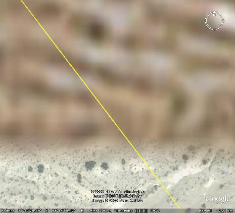
Now compare that with this shot I took of the obscure port facility of Churchill, Manitoba (population 963), from a distance of roughly half a kilometre, showing building specific resolution.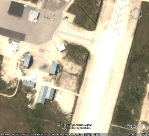
Does it really make sense that we have high-quality imaging for Churchill but not for the Afghanistan-Pakistan border? Hell, I'm at 55°37'21.07"N, 117°08'27.42"W right now, 61 km northwest of High Prairie Alberta, and can make out individual round bales of hay. This is the sort of thing which worries me.
2006-12-23
Seems to me this more than this "no WMD" nonsense is the real "intelligence failure"
by Feynman and Coulter's Love Child at 1:47 pm
Labels: Photos, Race Religion and Sex, Technology
Subscribe to:
Post Comments (Atom)

2 comments:
You can probably bet that the US Government Spy Sattelites are not accessible to Google. But... great line of reasoning there.
I used to live in Churchill Manitoba and I do not believe that is a picture of the port. Sorry!
Post a Comment